Pepperbox Hill, nr. West Grimstead and Alderbury, Wilts.
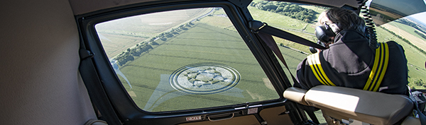
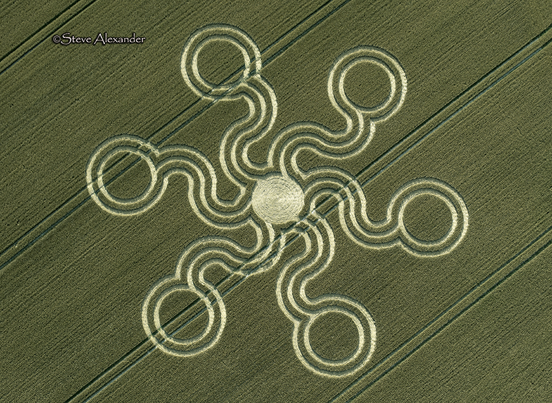
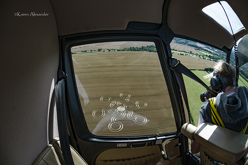
This circle was reported on the 23rd of July and is in a field of golden wheat. It measures approximately 180ft in diameter. This crop circle is a six-armed design based on linked circles. Its wavy lines give it a natural feel, rather than a strictly geometric construction – although the underlying geometry will most probably show that it has a
logical geometric blueprint. More of this when I have drawn it.
Visiting: At the time of writing we are not aware of permission being granted by the farmer to enter the field. You will need to find the farmer and ask his permission to enter before visiting this crop circle.
Is it, or isn’t it? There appears to have been some confusion in regards to whether or not this circle had been cut. It was reported on the 24th of July that this circle had been cut out of the field. However, by later in the day it was clear that the circle was in fact still there and had perhaps been confused with a similar looking circle (from
earlier) which had indeed been cut. We’d like to thank all our crop circle colleagues who kept in touch and helped to clarify the status of the circle before we flew. With special thanks to Mark Fussell at Crop Circle Connector. As of the evening of the 24th of July the circle was still intact in the field.
Location: The formation is located in a field on Windwhistle Lane off the A36 close to Alderbury, (see Google Maps link for exact location on our website) and is also overlooked by the very picturesque Pepperbox Hill. We could clearly see ‘Erye’s Folly’, or ‘The Pepperbox’ as it’s also known when we flew over the circle. Pepperbox Hill is a place
of outstanding natural beauty and is famed for its rare wildflowers and butteries. The pretty Folly is on a natural viewing spot with spectacular views across the landscape. Follow the link to the National Trust for more details and information about how to get there on our website.